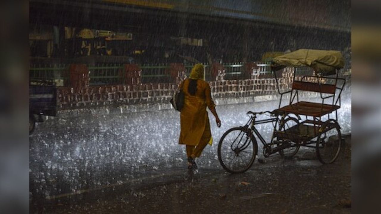
When we talk about natural disasters, floods and cyclones often steal the headlines. But this week, Odisha—an eastern state in India with a long coastline along the Bay of Bengal—reminded us that sometimes it’s the “smaller” systems, like a low-pressure area, that can suddenly turn deadly. Overnight, a seemingly routine weather system intensified into a depression, leading to heavy rainfall, flash floods, and disruptions across several districts.

This isn’t just a story about rain; it’s a tale of how vulnerable communities face sudden shocks, and what lessons we can all draw—from small-town farmers in Odisha to disaster planners in the U.S. Midwest dealing with tornadoes.
Odisha Hit Hard as Heavy Rains Pound State
| Topic | Details |
|---|---|
| Location hit | Southern & coastal Odisha, India |
| Weather system | Low-pressure intensified into a depression |
| Red Warning | Districts: Koraput, Malkangiri, Nabarangpur |
| Yellow Warning | Districts: Ganjam, Nayagarh, Boudh, Balangir, Puri, Cuttack, etc. |
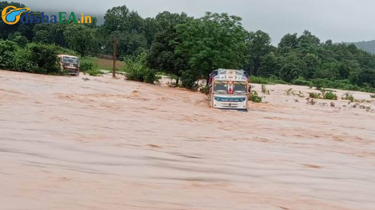
| On-the-ground impact | Landslides, bridges submerged, uprooted trees Indian Express |
| Expected duration | Heavy rainfall till August 23 |
| Official website | IMD Official Site |
Odisha’s latest brush with disaster shows us a hard truth: nature doesn’t always give us a long heads-up. From a quiet low-pressure zone to a damaging depression, the shift was swift and painful. Yet, the lessons are clear. Be alert, prepare ahead, and treat every warning like it could be the one.
As climate change intensifies rainfall patterns globally, from California floods to South Asian depressions, the key is not panic but preparedness.
What Exactly Happened?
A low-pressure system is nothing new for folks in Odisha—these occur regularly in the Bay of Bengal. But what makes this case alarming is how fast the system intensified into a depression overnight.
- By the time people in Malkangiri and Koraput woke up, they were already dealing with flooded roads, landslides, and bridges cut off from the mainland.
- The Indian Meteorological Department (IMD) had already issued red and yellow warnings, but in practice, many remote villages found themselves unprepared.
Imagine a regular rainstorm in Florida suddenly cranking up into a tropical storm—without the luxury of a multi-day warning. That’s what Odisha faced.
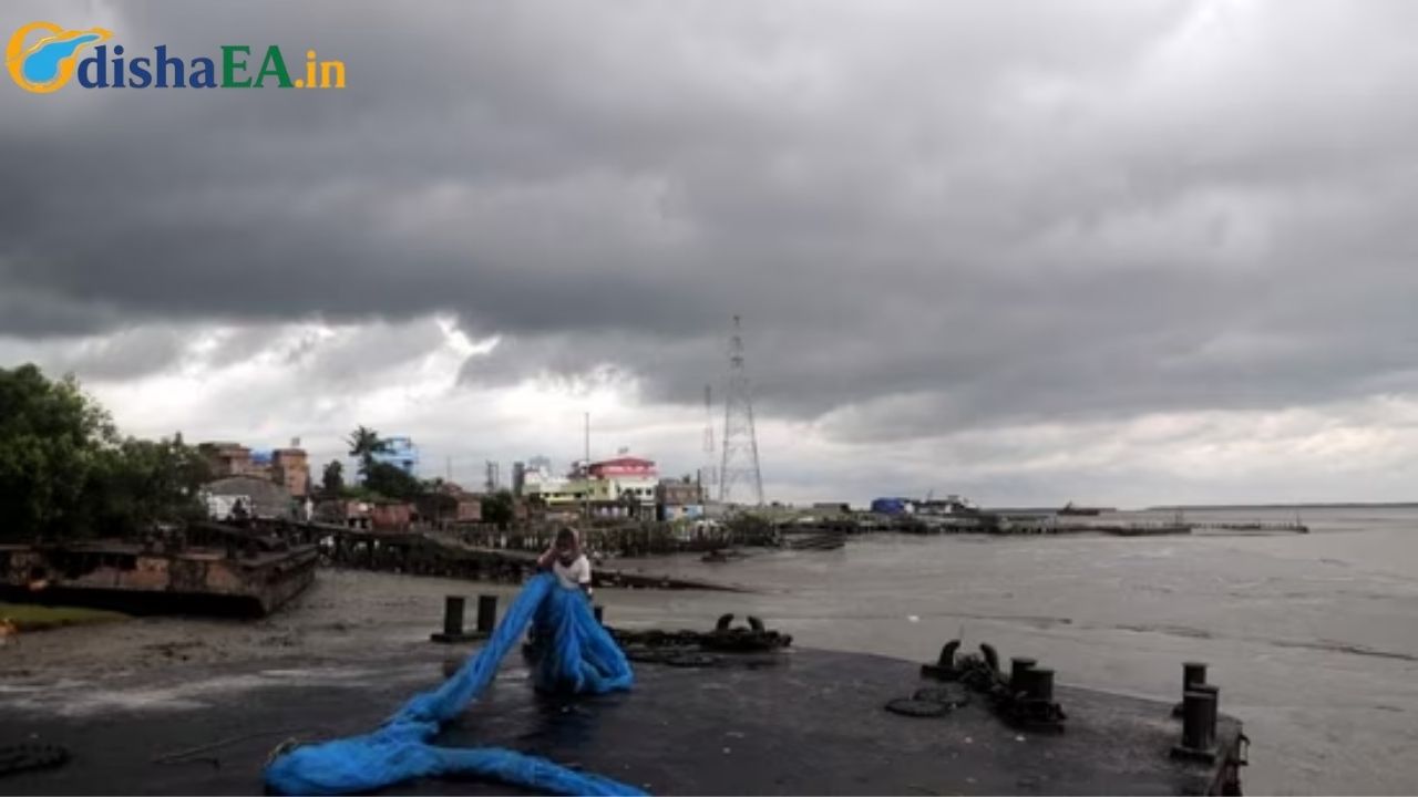
Why This Matters: Context from the Bay of Bengal
The Bay of Bengal is like the “hurricane alley” of South Asia. Each year, the warm waters feed cyclones and depressions that batter coastal India, Bangladesh, and Myanmar. According to World Bank data, Odisha alone has faced more than 90 cyclones in the last century.
But here’s the kicker: depressions and low-pressure systems often get less attention compared to full-blown cyclones, yet they can unleash just as much rain. Think about how in the U.S., a tropical depression can dump more water than a hurricane. Remember Hurricane Harvey (2017)? The winds weren’t the biggest killer—it was the rainfall and flooding.
Breaking Down the Impact
1. Districts Under Red Alert
- Koraput, Malkangiri, and Nabarangpur are facing extremely heavy rainfall, raising fears of landslides in hilly terrain.
2. Infrastructure Disruptions
- Bridges and culverts are submerged.
- Road networks connecting Malkangiri to other parts of the state are cut off.
3. Humanitarian Concerns
- Farmers face damaged crops.
- Rural families risk losing food stocks stored in mud houses.
- Schools and government offices are closed in red-alert areas.
Lessons for All of Us
Now, you might be wondering: “I don’t live in Odisha. Why should I care?”
Here’s the deal: Disaster readiness is universal. Whether it’s a hurricane in Texas, a wildfire in California, or a flash flood in Odisha, the principles of survival and recovery are the same.
Practical Takeaways:
- Always respect weather warnings
- Just like the National Weather Service (NWS) in the U.S. pushes tornado alerts, the IMD issues red and yellow warnings. Don’t brush them off.
- Prepare an emergency kit
- Include water, dry food, flashlight, first-aid, and key documents in a waterproof pouch.
- FEMA recommends at least three days’ supply of essentials (FEMA Ready Guide).
- Understand your local geography
- Folks in Odisha know their rivers swell fast. Similarly, if you live in Houston, you know which bayous overflow first. Knowledge saves lives.
The Science Behind Low Pressure and Depressions
What is a Low-Pressure Area?
- Think of it as a “soft spot” in the atmosphere where air rises, creating clouds and rain.
How Does It Turn into a Depression?
- Warm, moist air rises.
- More and more clouds form.
- If the wind patterns feed the system, it deepens—sometimes becoming a cyclone.
In Odisha’s case, the system stayed short of cyclone status but still packed a heavy rain punch.
A Step-by-Step Guide to Flood Safety
Here’s a quick guide anyone can use, whether in Odisha, Oklahoma, or Omaha:
Step 1: Stay Informed
- Sign up for text alerts from weather services.
- Follow official meteorological agencies (like IMD in India, or NOAA in the U.S.).
Step 2: Make a Family Plan
- Decide a meeting spot in case you’re separated.
- Know the nearest shelter locations.
Step 3: Protect Your Home
- Elevate electrical wiring and appliances if floods are common.
- Keep sandbags handy for quick barriers.
Step 4: During the Flood
- Avoid walking or driving through moving water. Just 6 inches can knock you down.
- “Turn Around, Don’t Drown”—a simple slogan that saves lives.
Step 5: After the Flood
- Don’t rush back. Wait for official all-clear.
- Beware of snakes, contaminated water, and weak building structures.
Landslide Blocks Damanjodi–Narayanpatna Route in Koraput After Torrential Rain
Odisha’s Weather Alert: Flood-Prone Zones to Face Rain Till August 19
Odisha Districts Warned of Heavy Rain and Thunderstorms for Next 5 Days
FAQs
Q1: Why is Odisha so prone to these storms?
A: Odisha sits right on the Bay of Bengal, where warm waters fuel frequent storms. Its long coastline and river systems make it especially vulnerable.
Q2: What’s the difference between a depression and a cyclone?
A: A depression has lower wind speeds (around 20–30 mph), but it can carry massive amounts of rain. Cyclones, like hurricanes, add destructive winds on top of rain.
Q3: How do these events affect the economy?
A: Crops like paddy (rice) get destroyed, roads and power lines collapse, and relief operations cost millions. Long term, repeated floods stunt growth in rural areas.
Q4: Can we predict these overnight intensifications better?
A: Meteorology is improving, but systems like these can still surprise experts. Investments in radar, satellites, and local warning systems are crucial.