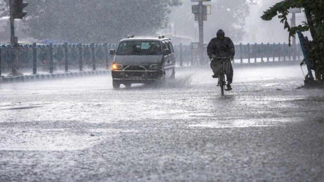
As we head into the peak monsoon season, the Indian Meteorological Department (IMD) has issued a warning for Odisha, one of India’s most vibrant coastal states, as it prepares for a major weather event. The IMD is forecasting the development of a low-pressure area in the Bay of Bengal, which is expected to bring heavy rains, strong winds, and thunderstorms to Odisha over the coming days. This phenomenon is set to impact the region from July 23 to July 25, 2025, potentially leading to hazardous conditions, especially for coastal and low-lying areas.

In this article, we’ll dive deep into what this low-pressure system means, how it affects the region, and what precautions residents and visitors should take to stay safe. Whether you’re a local resident, traveler, or someone just curious about this weather event, this guide will break down the forecast, provide actionable safety tips, and offer key insights into how you can prepare for what’s to come.
Odisha Braces for Intense Rainfall
| Key Information | Details |
|---|---|
| Weather Event | Low-pressure area in Bay of Bengal |
| Impact Period | July 23 to July 25, 2025 |
| Affected Areas | Odisha, especially districts like Mayurbhanj, Keonjhar, and Balasore. |
| Severity | Heavy to very heavy rainfall (12–20 cm) in some areas, along with thunderstorms and gusty winds. |
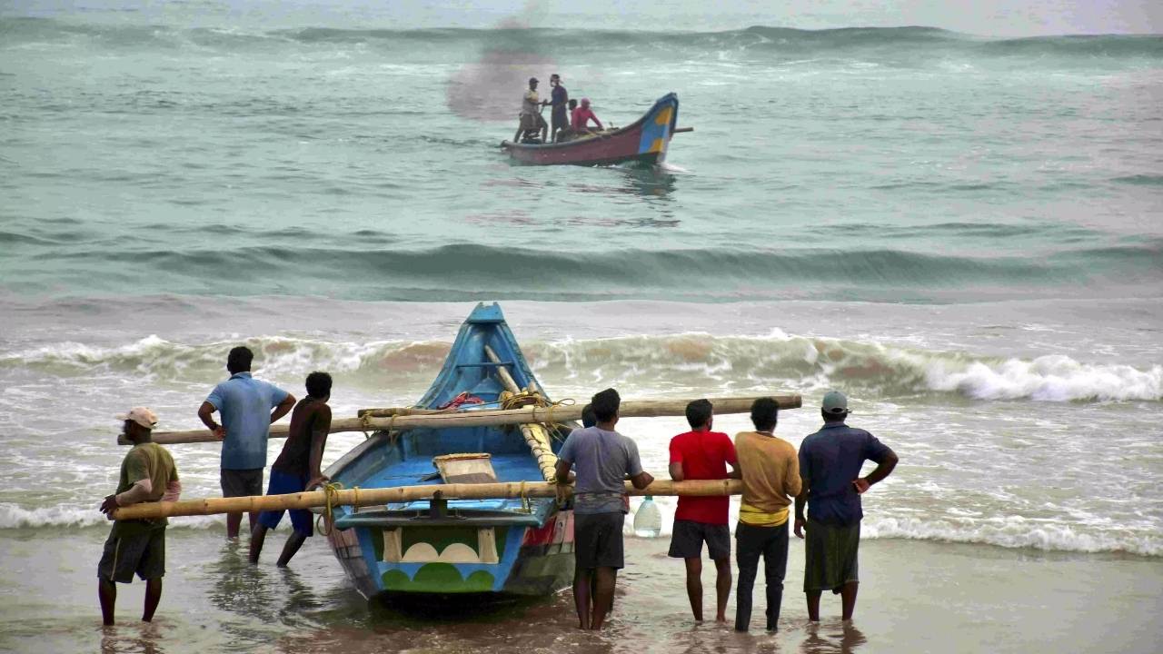
| Fishermen Advisory | Refrain from venturing into the sea on July 24 due to rough sea conditions. |
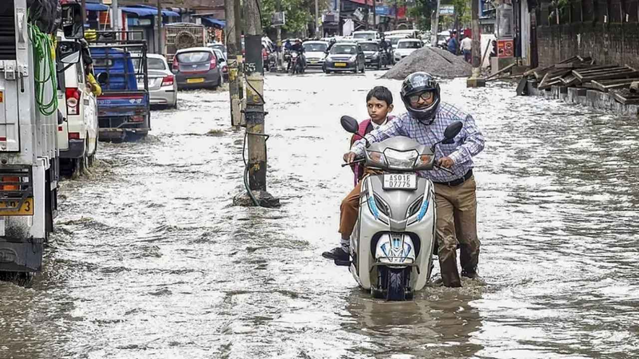
| Possible Impact | Localized flooding, crop damage, landslides, disruption to traffic and transport. |
| Safety Tips | Stay indoors during storms, avoid unnecessary travel, and secure weak structures. |
| Official Forecast | IMD Bhubaneswar Centre |
Odisha’s preparation for the low-pressure system and its potential impacts is crucial in minimizing damage and keeping everyone safe. By understanding the weather warnings, taking precautions, and staying informed, you can weather this storm without a hitch. As the IMD forecast points to a challenging few days ahead, stay prepared and remember: safety always comes first.
Stay safe, stay informed, and don’t hesitate to reach out to local authorities for assistance. For more details, visit the IMD Bhubaneswar Centre for real-time updates.
What is a Low-Pressure Area and Why Does It Matter?
Before we dive into the specifics of the weather event, it’s important to understand what a low-pressure system is and why it’s significant.
In simple terms, a low-pressure area is a region where the air pressure is lower than the surrounding areas. This causes air to move towards the low-pressure center, and as it rises, it cools and condenses, forming clouds and precipitation. In the context of the Bay of Bengal, this can lead to heavy rainfall, strong winds, and thunderstorms.
For Odisha, a state already familiar with the challenges of the monsoon season, such systems can cause a range of issues, from flooding to agricultural damage. Farmers in Odisha, particularly those who rely on crops like rice, must be especially prepared, as their livelihoods are often impacted by erratic weather.
The IMD’s Forecast for Odisha
According to the IMD, the low-pressure system is expected to develop in the Bay of Bengal around July 24, 2025. The IMD’s predictions suggest that the system will bring intense rainfall and gusty winds to the region, especially on July 23 and 24.
Key Affected Areas
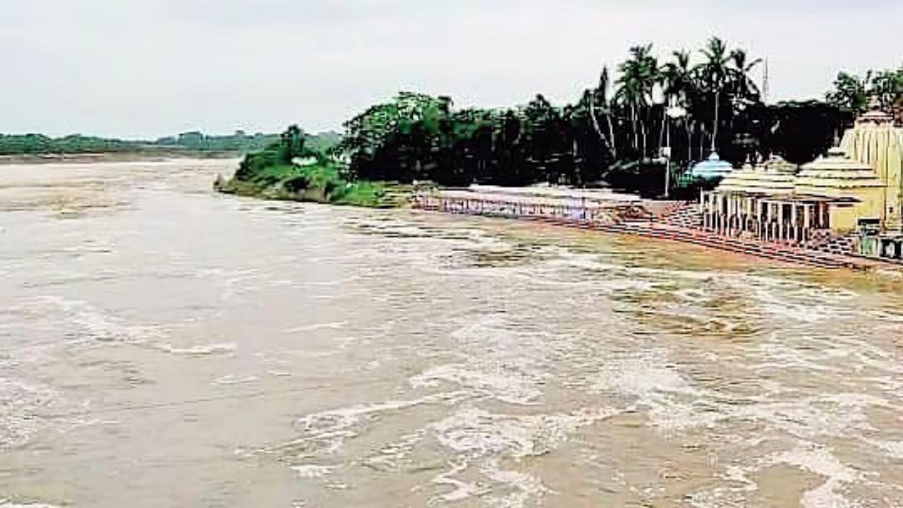
Odisha is a diverse state, with its coastline vulnerable to the worst impacts of a low-pressure system. Coastal districts like Mayurbhanj, Keonjhar, Balasore, and Cuttack are likely to experience the heaviest rainfall, with up to 20 cm of rain expected in certain areas. Inland districts, including Ganjam, Koraput, and Rayagada, will also see heavy rain, though not as intense as in coastal regions.

Warnings Issued by IMD
The IMD has issued a series of weather alerts to ensure public safety. These include:
1. Orange Warning – Be Prepared
Heavy to very heavy rainfall (12–20 cm) with thunderstorms and gusty winds (30–40 km/h) are expected in districts like Mayurbhanj, Keonjhar, and Balasore on July 23 and 24. People in these areas should be prepared for localized flooding, landslides, and possible damage to property.
2. Yellow Warning – Be Aware
Districts such as Dhenkanal, Kandhamal, and Gajapati are expected to receive 7–11 cm of rainfall, along with thunderstorms. While the conditions are not as severe as the orange warning areas, residents should still remain vigilant.
3. Coastal Advisory
Fishermen are advised not to venture into the sea on July 24, as rough to very rough sea conditions are expected, with wind speeds reaching 35–45 km/h and gusts up to 55 km/h. The IMD also suggests that those already at sea return to shore immediately.
Safety Measures for Residents and Visitors
With the forecast calling for heavy rainfall and high winds, here’s how you can stay safe:
1. Stay Indoors During Storms
It’s always a good idea to stay inside when a storm hits. Avoid electrical appliances and unplug them to prevent power surges and fires. Thunderstorms can sometimes lead to lightning strikes, so it’s best to stay away from windows and doors.
2. Avoid Travel in Heavy Rain
Driving in heavy rain can be extremely dangerous. If you live in a flood-prone area, avoid traveling unless absolutely necessary. Even if your route seems safe, there could be puddles, fallen trees, or other obstacles. Stay updated with local news for road conditions.
3. Secure Your Property
Strong winds and rain can damage weak structures, such as roofs and windows. Check if your home is secure, especially if you live in a hut or older building. Use sandbags or tarps to prevent water from flooding your home.
4. Prepare for Possible Flooding
If you live in a flood-prone area, make sure you have an emergency kit that includes:
- Non-perishable food
- Bottled water
- First aid supplies
- Flashlights and batteries
- Important documents in waterproof bags
5. Stay Updated
The weather can change rapidly, so stay informed through reliable sources. The IMD website and local news channels are the best places to get updates on the weather.
Impact on Agriculture and Economy
For many residents of Odisha, agriculture is the backbone of their livelihoods. Farmers in districts like Kandhamal and Koraput are bracing for the potential impact of the rain on their paddy crops, which could be damaged by waterlogging and strong winds.
In addition to farming, infrastructure and transportation could also face disruptions. Roadways and railways may be flooded, and landslides could block essential routes, especially in hilly areas.
The Economic Cost
In recent years, the state has seen a rise in weather-related disasters, leading to increased costs for both recovery and preparedness. In 2020, Odisha faced significant damage from the Cyclone Amphan, which resulted in over $13 million in losses for the agricultural sector alone.
The current forecast of heavy rainfall could exacerbate these costs, especially for farmers dependent on monsoon rains for their crops.
Rainfall Likely in Odisha with Low Pressure Developing Over Bay of Bengal
Odisha Prepares for Nature’s Wrath: Monsoon Rainfall to Intensify from July 21
Odisha Braces for Heavy Rain: IMD Issues Yellow Alert for Six Districts Today
FAQs
1. What should I do if I live in a flood-prone area?
Make sure to have an emergency evacuation plan, sandbags to block water, and an emergency kit ready. Keep your important documents in waterproof bags.
2. Is it safe to travel during heavy rain?
It’s best to avoid travel during heavy rainfall, as road conditions can change rapidly. If you must travel, make sure your vehicle is equipped with emergency supplies and that you have a reliable map.
3. How can I protect my crops from flooding?
Farmers should ensure proper drainage systems in their fields. If possible, try to harvest crops early to prevent waterlogging from damaging them.