As the monsoon season continues to roll across India, the Indian Meteorological Department (IMD) has issued a detailed weather warning for the state of Odisha from July 23 to 26, 2025. The forecast predicts widespread rainfall and thunderstorms, along with gusty winds and possible localized flooding. This article breaks down the essential details of this weather alert, offering clear insights and actionable advice for residents, travelers, and professionals to stay safe and prepared.
Context: The Monsoon Pattern and Odisha’s Weather
Monsoon rains are an integral part of India’s yearly climate cycle, especially for Odisha, which experiences heavy rainfall during this time of year. The IMD’s forecast is triggered by a low-pressure area forming over the Bay of Bengal. This weather system is expected to intensify into a depression, bringing even more rain, thunderstorms, and gusty winds to several regions of Odisha.

The low-pressure system typically causes unpredictable weather conditions, and this particular formation could affect both coastal and inland areas of the state. Understanding the IMD’s weather warning and its potential effects is crucial for everyone living in or traveling through Odisha.
IMD’s Forecast for July 23–26
| Key Data | Details |
|---|---|
| Date of Forecast | July 23–26, 2025 |
| Weather Conditions | Widespread rainfall and thunderstorms with gusty winds expected. |
| Alert Levels | Orange Warning: Heavy to very heavy rainfall. Yellow Warning: Heavy rainfall with gusty winds. |
| Impacted Regions | Coastal and inland areas including Balasore, Bhadrak, Sundargarh, Mayurbhanj, Cuttack, Sambalpur, and more. |
| Potential Impacts | Localized flooding, waterlogging, reduced visibility, and disruption in transportation. |
| Source | IMD Official Website |
The upcoming weather system over Odisha from July 23 to 26 promises to bring a mix of heavy rainfall, thunderstorms, and gusty winds to the state. Whether you’re a resident, traveler, or professional in the region, staying prepared is key to staying safe. Keep an eye on weather alerts, make necessary preparations for your home, and avoid travel during the worst conditions.
For official updates, visit the IMD Bhubaneswar page. By following the right precautions, you can weather the storm and keep yourself and your loved ones safe.
What to Expect from the Weather: Breaking Down the Forecast
The IMD’s alert for Odisha spans four days, and the region can expect a series of intense weather events. Here’s what the forecast says:
1. Rainfall and Thunderstorms
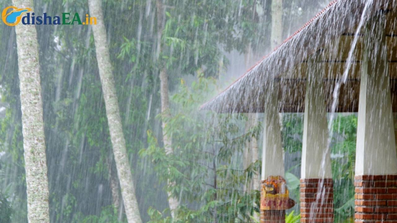
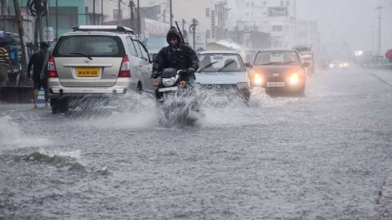
From July 23 to 26, heavy rainfall (ranging from 50 mm to 100 mm) is expected in several districts, including Cuttack, Nayagarh, and Mayurbhanj. The coastal areas will likely experience thunderstorms accompanied by gusty winds up to 40 km/h.
Key Tip: Be sure to stay indoors or avoid outdoor activities when thunderstorms are in full swing. Avoid driving during heavy rain as it could severely affect visibility.
2. Gusty Winds
As the low-pressure system strengthens, gusty winds will likely cause disruptions in local areas. Winds could blow at speeds between 30–40 km/h, which may damage weak structures, trees, and power lines.
What You Can Do: Ensure all loose items are secured, especially if you live in an area with poorly anchored structures. Make sure to check for power outages and stock up on emergency supplies.
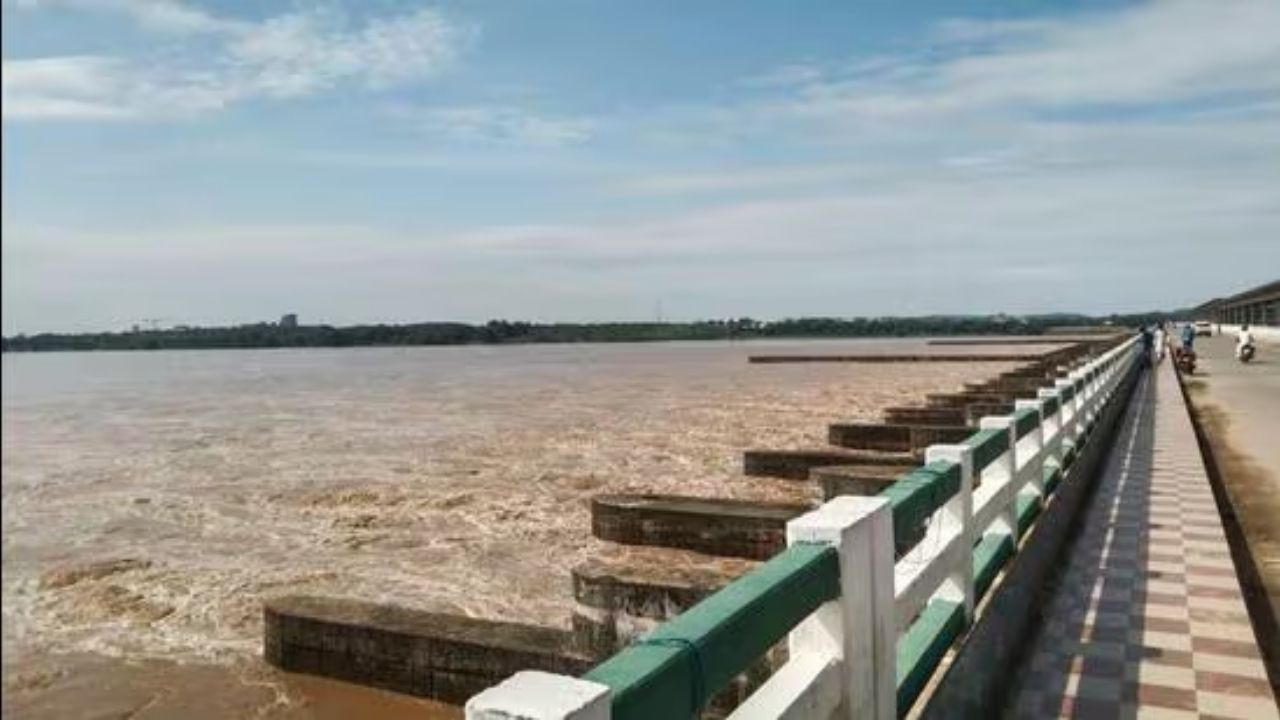
3. Possible Flooding
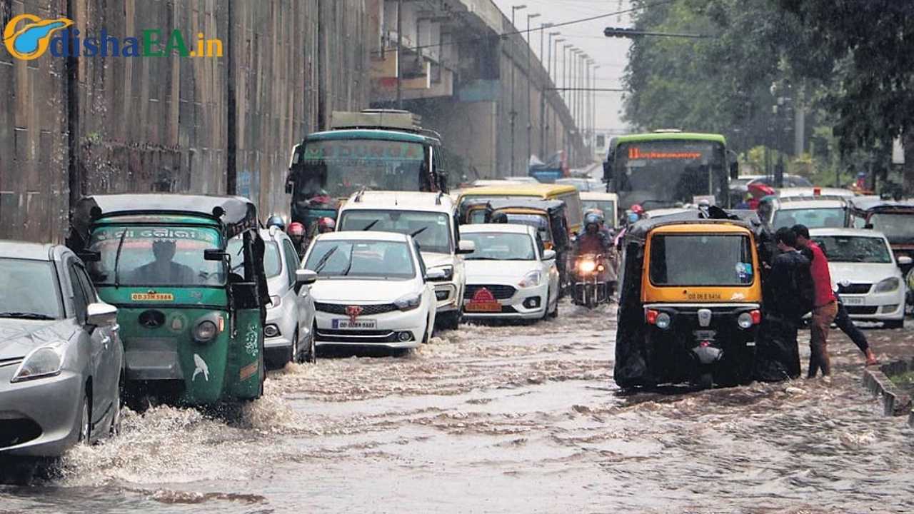
Localized flooding in low-lying areas is a significant risk. Heavy rains, combined with insufficient drainage in some areas, could lead to road blockages and waterlogging. Areas like Cuttack and Bhubaneswar may face temporary disruptions.
Precautionary Advice: Avoid traveling in flood-prone areas and stay updated with the latest weather bulletins. Plan ahead if you live in a flood-risk zone.

A Deep Dive Into Key Areas Affected by the Weather
The IMD’s forecast specifies that both coastal and inland regions of Odisha will be impacted. Here’s a more detailed look at these areas:
1. North Coastal Odisha
Expect moderate to heavy rainfall in Balasore, Bhadrak, and Kendrapara, especially on July 23 and 24. These areas could see temporary waterlogging, especially near rivers or lakes. Thunderstorms are also expected, which could bring flash flooding in some places.
Tip for Residents: Coastal areas are especially vulnerable to thunderstorms, so ensure your home is storm-ready. Secure windows and doors.
2. South and Interior Odisha
The districts of Sambalpur, Keonjhar, Sundargarh, and Bargarh will see heavy rainfall, especially on July 25 and 26. These areas may experience strong winds and thunderstorms, but the risk of flooding is also high in areas where rivers overflow.
Best Practice: Keep track of the IMD’s local alerts and follow their guidance on road safety and travel advisories.
3. Urban Areas Like Bhubaneswar
The capital city of Bhubaneswar will experience moderate rainfall and thunderstorms, with possible disruptions to traffic and daily activities. Waterlogging and street flooding could occur in key areas like Kalinga Nagar, Baramunda, and Patia.
For Commuters: Use public transport to avoid getting caught in traffic jams caused by poor road conditions after heavy rains.
What You Need to Know About IMD Warnings
The IMD issues a range of weather warnings, including Orange and Yellow, depending on the severity of the forecast. Understanding these warnings will help you stay safe.
- Orange Warning: Be Prepared. This indicates a high likelihood of severe weather, such as heavy rains, thunderstorms, or strong winds. Prepare your home, secure loose objects, and stay indoors during the worst conditions.
- Yellow Warning: Be Aware. This indicates moderate weather conditions that might still cause disruptions. Stay alert and avoid unnecessary travel.
Odisha Braces for Intense Rainfall: IMD Forecasts Low-Pressure System Impact
Rainfall Likely in Odisha with Low Pressure Developing Over Bay of Bengal
Odisha Prepares for Nature’s Wrath: Monsoon Rainfall to Intensify from July 21
FAQs
1. How do I stay safe during a thunderstorm?
- Stay indoors, away from windows and electrical devices. If you’re caught outside, avoid tall trees and open fields.
2. What should I do if there’s flooding near me?
- Avoid crossing flooded roads. If trapped in a flooded area, move to higher ground immediately and seek shelter.
3. How can I prepare my home for the storm?
- Secure windows and doors, ensure gutters are clear, and make sure there are no loose objects in your yard that could become projectiles in high winds.
4. Will the weather affect flights or transportation?
- Yes, flights may be delayed, and trains/buses might experience disruptions. Check with transport providers for the latest updates before traveling.
5. How do I track real-time weather updates in Odisha?
- You can follow the IMD Bhubaneswar Twitter page or regularly check their official website IMD Odisha.